- Home
- | Real Estate
- | Vacation Rentals
- | Puerto Escondido Info
- | Maps
- | Beaches
- | About Us
- | Visitor Comments
- | Contact
     |
||||||||||||
Puerto Escondido Oaxaca Mexico Maps
|
||||||||||||
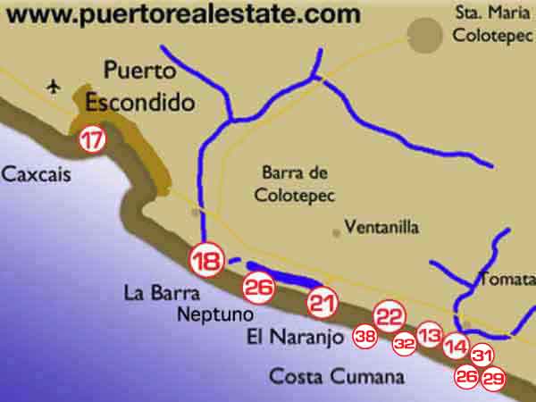
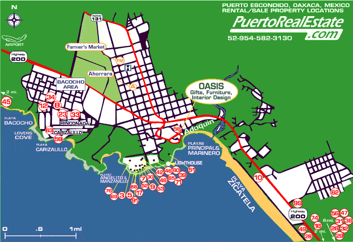 Map of Puerto Escondido AreaThe map below gives one a a general idea of where the beach property developments that lie to the southeast of town can be found. This includes, in order of distance La Barra, Laguna Naranjo, Rancho Neptuno and Costa Cumana.
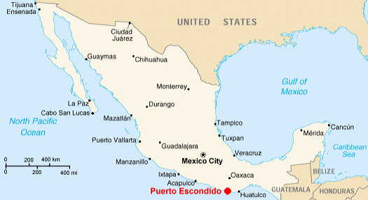
Map of MexicoWhere is Puerto Escondido? Highlighted in the map in red, you'll find Puerto Escondido which is located in the southern part of Mexico and is a coastal city within the state of Oaxaca. Oaxaca City is the state capital and is approximately 120 miles from the 'Hidden Port'. There is a road construction project is currently underway that is projected to reduce the travel time from Oaxaca City from 7 hours to just 3 hours.
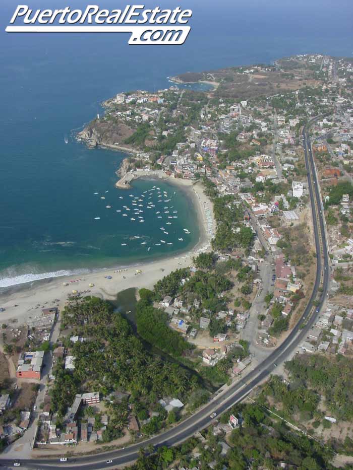
Pictures of Puerto Escondido from the skyThese aerial photographs were taken in March 2007. We took off from the Puerto Escondido airport and followed a route that covered the outskirts of the city from the northwest and then flew to the southeast of town. Along the way we were able to get great pictures of the cove beaches, the center of town as well as the beautiful seaside and beach front properties that are located southeast of the village. |
Copyright Nancye Radmin ©2003-2020 Puerto Escondido Real Estate & Vacation Rentals


